It had been awhile since I have been able to get out into the woods so I set aside Saturday for a hike. The weather up north in New Hampshire didn't look like it was going to cooperate, so I looked for a hike closer to home. The South Taconic Trail looked like it would be the perfect place to go. I arrived at the southern trailhead just before 9am and planned to hike about 6.5-7 miles out to Alander Mountain summit. Temps were in the mid to upper 60's when I started out. The trailhead is in a small residential neighborhood with parking for 4-5 cars. This is where in January I had to turn around due to trail conditions, thick ice and snow, that made the climb almost impossible.
The trail starts out with a gradual climb, then gets very steep very quickly.
 |
| "Yes, the trail goes this way!" |
 |
| Still climbing |
This 1/4 mile section is treacherous, it is a pretty hard scramble up, with loose rock and dirt on much of the trail. Once you get past this section it is a nice trail that works its way over ledges and through hardwood forest. The first high point encountered is South Brace Mountain. South Brace is 2304ft with a few views to the east and south.
The trail continues on, dropping down a little before climbing up to Brace Mountain. Brace Mountain is 2311ft and a popular spot for hang gliders. There is a large cairn with a windsock on the summit. I paused here for some pictures and a snack, but the sun was getting higher in the sky and the temps were climbing so I moved on.
 |
| Approaching the summit of Brace Mountain |
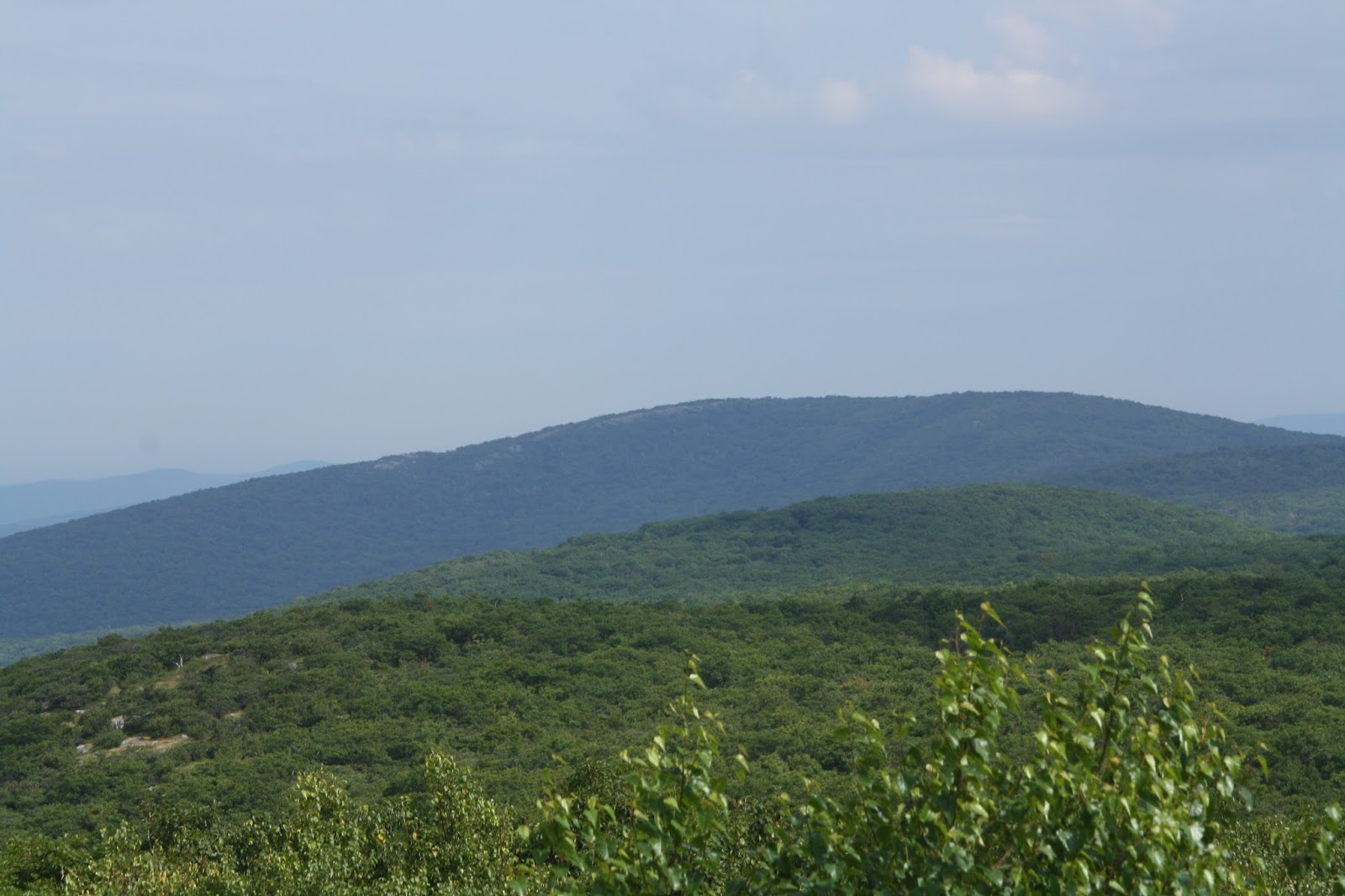
 |
| Looking West toward the Catskills |
From Brace Mountain it is a ridge walk, coming quickly to the intersection with the Mt. Frissell Trail, and then continuing on. Soon descending into the forest again the trail meanders along before a fairly steep climb up Alander Mountain. The summit of Alander Mountain, 2239ft, is open with scrub Oak and good views south to Brace Mountain. I arrived at the summit at noon. By this time the day was getting pretty hot so I did not stay on the summit very long. I took a few pictures of the firetower footings and USGS markers and headed back down to find some shade. On my way up Alander I met a family hiking who told me to be on the look out for rattlesnakes.
 |
| Snake skin |
I was excited that I may finally see a Timber Rattlesnake but it was not to be. I think the mid day sun was to hot for them to be out in the open. I did find a snakeskin shed that I think must have been from a rattlesnake. Hopefully next time I'm in that area I will get to see one. I ate lunch on the trail in a shady spot and rested for about 20 minutes.
 |
| Looking South toward Brace and South Brace Mountains |


After lunch it was time to turn around and head back to the car. I had hiked about 7 miles at this point and was not looking forward to another 7 back the way I had come, but there was no getting around it. Once down from Alander Mtn. the trail gradually climbs back to the ridge. I was pretty hot at this point and needed to rest frequently to try to cool off. I brought 2 liters of water with me and drank one on the way out and I drank continuously on the way back. At this time of year there is no reliable water source along this stretch of trail. I came across one stream that had a few puddles left in it, but no running water. Even though I did have a filter, the water didn't look like something I would want to drink. Only as a last resort type water, which I was not at at that point. The heat got to me pretty good and my pace slowed considerably with numerous breaks. When I reached the steep climb down to the car I was relieved to know I was close to finishing. I got to my car about 4pm having hiked a total of 15.25 miles. I let the air conditioning in the car cool me down as I drank some water.
This was a good hike. The trail was both difficult and easy in sections. I enjoyed the views from both summits and I think they would be great during fall leaf season. The heat and sun exposure on the open ledges took their toll on me, sapping my energy and making the return miles hard. I will be back to finish the South Taconic Trail when it is cooler and the leaves are turning.


No comments:
Post a Comment