Wednesday, December 23, 2015

Foggy day over Hogsback

Today was my first day of vacation for the Christmas holiday and what better way to start then to go hike in the woods.  It was also a perfect opportunity to try out the GoPro camera that just arrived in the mail.  I decided to hike a trail with no name that ends at a nice lookout overlooking Hogsback Reservoir.  The hike is nice and level, with only a few small ups and downs.  I passed many stone walls and old home sites on the way to the look out.


As I approached the end I could see that there was a good amount of fog in the valley and a low cloud cover but I hoped I would still get some views.  The view was mostly of clouds and fog today, but the tops of the hills all around me poked through.  The fog in the valley sat over the water without moving much but it did open up for a few glimpses.  I played around with different settings on the camera for awhile and then started back.


I decided to do a little bushwhacking on the way back and climbed up and over the hill the trail goes around on the way in.  This way was interesting with rock outcroppings and some views out through the trees.  I made a short loop then hooked back up with the trail and made my way out.  


I didn't see any wildlife other then a few squirrels and chipmunks today, but I know this area is home to moose and had hoped to see one. I hiked about 3.25 miles on this out and back trail.  

Sunday, December 6, 2015

AT section hike with the scouts - Ice Gulch to Jug End

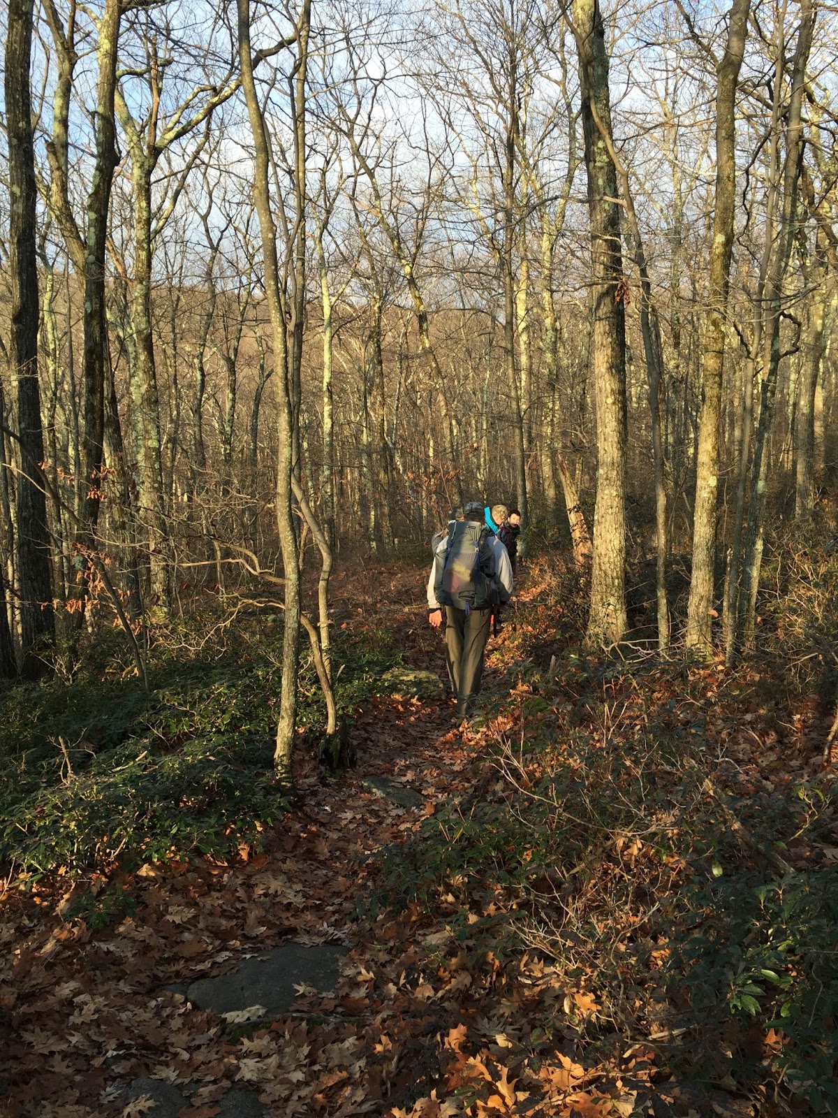
The weather was almost perfect for this trip along the Appalachian Trail.  This was a short backpacking trip with some of the scouts from my troop.  We hiked south to Tom Leonard shelter at night and set up camp.  After a quick dinner of Subway in the hiker parking lot we flew up the trail and made it to camp in record time.  It was fun to do a night hike as it is different and gives a new perspective of the trail. We arrived at the shelter a little after 8pm and set up and did our camp chores. The scouts slept in the shelter, which was empty, while my fellow leader and I hung our hammocks just outside the shelter.  After a brief campfire, we turned in early.  The weather was still a little cloudy with a breeze.  Temps would drop to about 32* for the night.  Beautiful.


Everyone was up and moving by 7am and we packed up and cooked breakfast.  Our plan was to begin hiking by 8am.  The morning was crisp and cool with bright sunshine.
Love this view over Ice Gulch

Breakfast time

Another great night sleep in my hammock
Our timing was right on the spot as we started hiking at 8am, heading south toward Jug End.  From Tom Leonard shelter the trail winds through hardwood forest and climbs slightly to the ridge over looking the Housatonic River valley and the town of Sheffield. There is a smattering of views along the way now that the leaves are all down, which was nice.  The leaves do pose a slipping hazard on the trail but we all were careful and no one fell.  Once on the top of the ridge there are nice views to the west.  Mount Everett is plain to see along with many other peaks of the Taconics.  


After enjoying the views and having some snacks it was time to go down.  We would descend about 1100ft to the Housatonic River.  Some parts would be steep others were more gradual.  The beauty of the trail was awesome, I really enjoy looking at all the different rock formations and the variety of trees.  Once we reached the river we were hiking through farm fields, empty corn fields ready for winter.  The terrain leveled out and we made good time.  We reached the site of Shay's Rebellion and stopped for lunch.  


Housatonic River


Lunch break
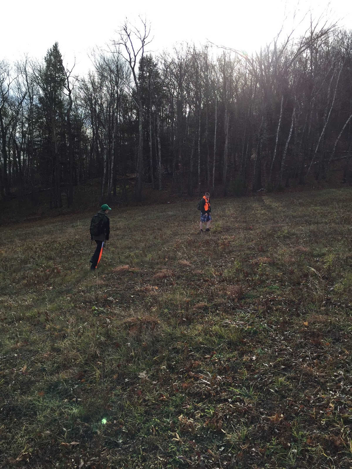
We were close to the end after lunch and we hiked through the swampy section and up through more farm fields, passing some sheep who looked at us like we were crazy.  As we crossed over route 41 and looked back at the ridge where we had been that morning the boys commented on how far away it looked.  We pushed on through a short section of forest and were soon at the car.  We hiked just over 10 miles and had a beautiful late fall day to do it.  The last 10 mile hike to complete Hiking Merit Badge for one of the scouts and a great hike/trip for the rest of us.  
Watching the sheep as we pass by

Looking back at where we had been
For this trip I packed as if for a longer trip.  I used the Gossamer Gear Mariposa pack that is my go to pack for just about any overnight trip.  Here is a list of the other gear I brought for this trip:
Warbonnet Blackbird hammock
Warbonnet Superfly
UGQ Flight Jacket topquilt 0*
Hammock Gear Incubator underquilt 0*
2QZQ underquilt protector
GSI Pinnacle soloist cookset
Primus classic trail stove
Katadyn Hiker water filter
All of this gear I have used many times before and it has all proven to work very well for me as it did for this trip as well.  

Friday, November 27, 2015

South Taconic Trail - Rt 23 to Bash Bish Falls

I finished up the final northern section of the South Taconic Trail today with my son and some friends.  It was a beautiful day to hike, sunny and warm, with temps in the high 50's.  There was a nice breeze up on the tops of the mountains which was nice and kept us cool on this unusually warm late November day.  We started our hike about 10AM at the northern terminus, located on Rt 23 near the Catamount Ski area.  The trail winds along a dirt road for a little while before crossing a field and entering the forest and climbing.  Catamount had been making snow and as we made our way to the top of the mountain and the back side of the ski area we could see snow on some of the trails.
Crossing a field and entering the forest

Views


Snack time at the lift
Once at the top, the trail turns south and heads toward Mt Fray.  The trail goes along the ridge with a couple nice openings with views to the west, looking over Copake Falls and Hillsdale, NY.  The Catskills stand tall in the distance and look quite impressive.  We continued on, loosing some elevation before going up Prospect Hill.  We all enjoyed the views and lingered for a bit but pressed on so we could get to the next view.


State line maker.  Hidden just off the trail.
The trail continues on through hardwood forest, before starting to descend to the one road crossing on this section.  Once across Sunset Rock Road you walk through a green tunnel.  The Mountain Laurel and trees create a tunnel effect before opening up at the junction with a short spur trail to Sunset Rock.  

Sunset Rock offers nice western views as well and we sat for a spell and enjoyed.  Then it was back on the S.T.T.  This is the beginning of the descent to Bash Bish Falls and the car.  It starts out fairly gradual with only some moderately steep sections.  We decided to take the Cedar Brook Trail, a more direct route to the parking area and our waiting car.  The first part of this trail is very steep, descending down to Cedar Brook.


Once at the brook the trail is fairly level, slowly descending down to the parking area.  It crosses the brook a number of times and we all had fun seeing who would fall in, but no one did.  The brook has created a pretty deep gorge along this section with steep terrain on either side.  It was a rugged area. Eventually the trail moves away from the brook and ends across the street from the parking area for Bash Bish Falls.  The parking area was full as we made our way to the car and finished today's hike. We hiked 6 miles and made it to the car just after 2pm.  A great way to spend a warm late November day.


Now to look into the new section of South Taconic Trail recently opened at the southern end.  

Saturday, November 21, 2015

Bash Bish Falls and the STT!!


After what has seemed forever I had a day where nothing was pressing and I could get back into the woods and hike.  I decided to hike a section of the South Taconic Trail.  I have done the southern portion of the trail from Alander Mountain to the southern terminus so today I hiked from Bash Bish Falls south to Alander Mountain.  I was solo today so this was an out and back hike, which ended up being about 8.5 miles round trip.  I parked at the upper parking lot and started hiking about 10am. The trail goes down steeply to the viewing area for Bash Bish Falls.
The falls are quite a sight and I enjoyed the view for a few minutes then moved on, I had miles to cover.  From the falls I headed down the trail toward the New York parking area and crossed the river to pick up the South Taconic Trail.  The trail climbs steeply up from the river for about 1.3 miles.
 It is a tough climb to the top, then the trail levels out along the ridge.  Once on the ridge it was a nice hike to Alander Mountain.  It took about 2 hours to hike to the summit.


 I stopped at the Alander Mountain cabin and cooked lunch before the return journey.  The cabin was empty, but looks like it does get a good amount of activity.  It has a wood stove and bunks that will accommodate about six people.  I enjoyed making lunch there as it was out of the wind and has a counter and stool to sit on.

After putting everything back the way I had found it and securing the door I made my way back to the trail and headed back toward the car.  The return trip went well and I was back to the car by 3pm. Today was a beautiful fall day, with bright sunshine and temps in the 40's, a great day to hike. Another section of the South Taconic Trail done.