Wednesday, December 9, 2020

Mohawk Trail Complete!


I was able to get out this week and complete the last section of the Mohawk Trail.   I decided to hike a modified Pine Knob loop that ended on the last .6 miles of the Mohawk Trail.  I parked at the Pine Knob loop parking area and began hiking taking the route to the right.  The trail is flat for a little while before climbing through hardwood forest.


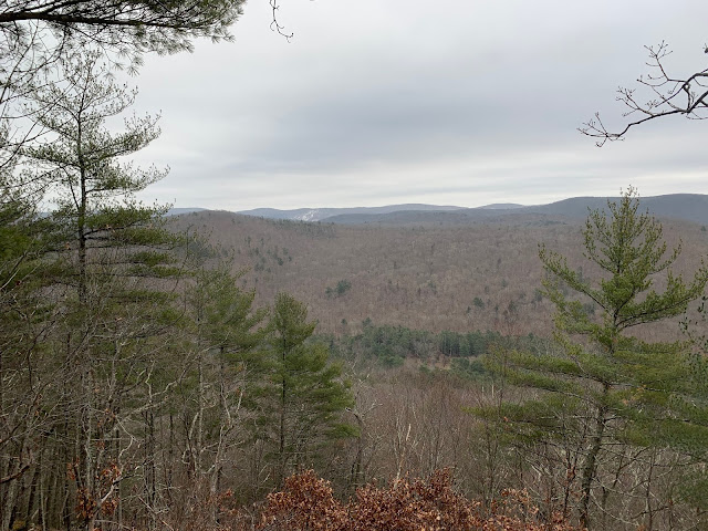
  Soon the views start to come through the trees and eventually the trees open up to a nice view of the Housatonic River valley. 


A few ups and downs over some rocky knobs and you find the intersection with the AT.  It felt good to be on the AT as it usually does.  I hiked along the AT and enjoyed the forest and the views as they came.  The trail starts its descent and eventually I came to intersection where the Pine Knob loop breaks off, I stayed on the AT south, hiking toward my destination of the Mohawk Trail. 


The AT continues going down eventually levelling out and then climbing slightly again.  There are numerous charcoal hearth circles all along the trail here, evidence from the early iron industry that was in this area in the 19th century.  Stonewalls and hardwoods all around as the trail continues south.  The intersection with the Mohawk Trail comes soon and it is a climb up to Breadloaf Mountain. 


The summit offers a nice view to the south.  Then it is a steady descent to the river valley and Route 7.  I walked the road, about a mile, back to my truck.  It was a cold cloudy day with flurries all through the hike.  Temps were in the high 20’s, but there was very little ice on the trail and no snow.  It was a good hike, totaling 5 miles in a loop.  It feels good to finally complete the 25.2 miles of the Mohawk Trail, it was the first backpacking trip I took all those years ago with the Boy Scouts.


Wednesday, December 2, 2020

Coltsfoot Mountain and the Mohawk Trail


Today was another section hike on the Mohawk Trail in Cornwall, CT.  My plan was to park in Cornwall Bridge and hike north to the Cathedral Pines.  I wasn’t quite sure what the mileage was but I planned to make this an out and back hike, retracing my steps back once I had finished.  The trail climbs the steep Dark Entry Road for about .5 miles before entering the woods.  Today was chilly with snow showers and periodic glimpses of the sun.  Once entering the woods the trail follows an old woods road until the trail crosses a stream to avoid private land.  It becomes rocky and rugged as you climb along.  There are a few waterfalls along this section and many stonewalls and a stone dam. 


The trees are predominantly evergreen Hemlocks and Pines.  Once the trail levels out it crosses into a mature hardwood forest with Oaks and Birch.  It is a fun trail the meanders through and climbs steadily eventually leading to a nice lookout.  I stopped and ate a snack and drank some water and enjoyed the view.   Continuing on the trail walks along the ridge, scattered views lookout over the valleys on both sides. 


It is a fun trail that allows you to set a good pace and cruise along.  Eventually the trail makes a steep descent down Coltsfoot Mountain.  There are some switchbacks and it is rough and steep climbing down.  The trail suddenly leaves the forest and crosses a stream on a wooden bridge and enters a farm field.  The livestock looked at me like I was crazy as I made my way past them. 

The plan changed once I reached the road and decided that hiking back the trail was not going to work.  I decided to hike the road back to my truck.  It was about a 3 mile road walk back to the truck along Route 4.  I hiked a total of 8.5 miles.  I liked this section of trail, it was a nice combination of rolling ridge walking and climbs and descents.  This time of year with the leaves gone, there was some nice views as well. 

Section hike on the Mohawk Trail


I hiked sections of the Mohawk Trail recently, on sections south of Route 4.  On Opt-out Friday, the day after Thanksgiving, I hiked the Cathedral Pines section up and over Mohawk Mountain and made my way back toward Route 4.  The Cathedral Pines had been devastated by a tornado back in 1989.  The evidence of the tornado is still easily seen by all the downed tree trunks scattered around the trail, slowly rotting into the ground and covered in green moss. The trail climbs from a small parking lot up through what is left of the old Pine and Hemlock trees.  A short road walk brings you to a private driveway where the trail follows an old farm road and climbs through farm field. 


Once up the hill from the farm the scrub forest is starting to take back the land.  It is a steady climb and soon you can see the ski trails of Mohawk Mountain.  After the scrub new growth the trail enters a mature hardwood forest with stonewalls crisscrossing the trail.  At a junction with the Mattituck trail, you turn left and climb up to the top of the ski trail and the chair lifts of the ski area.  There are some nice views to the north looking at the Taconic’s and Berkshires. 


Continuing on the trail crosses a state forest road and back into the forest.  There is a camp site near the road with a shelter and privy.  It is a fairly quick forest walk up and over a hill and back to Route 4.  I then turned around and retraced my steps back to the truck.  It was a nice hike with a good variety of terrain and some good views.  I hiked a total of 4.25 miles.  I finished another section of the Mohawk trail and a first section of the southern portion.